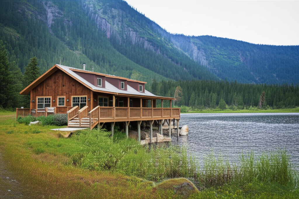
Minam Lodge sits in Oregon’s Eagle Cap Wilderness, accessible only by aircraft, horse, or a 14-mile hike. I flew in there with a group a few years back, and the experience of landing on that remote grass strip surrounded by wilderness is something that stays with you. This destination combines backcountry flying with wilderness accommodations, offering pilots a unique overnight experience in the Wallowa Mountains.
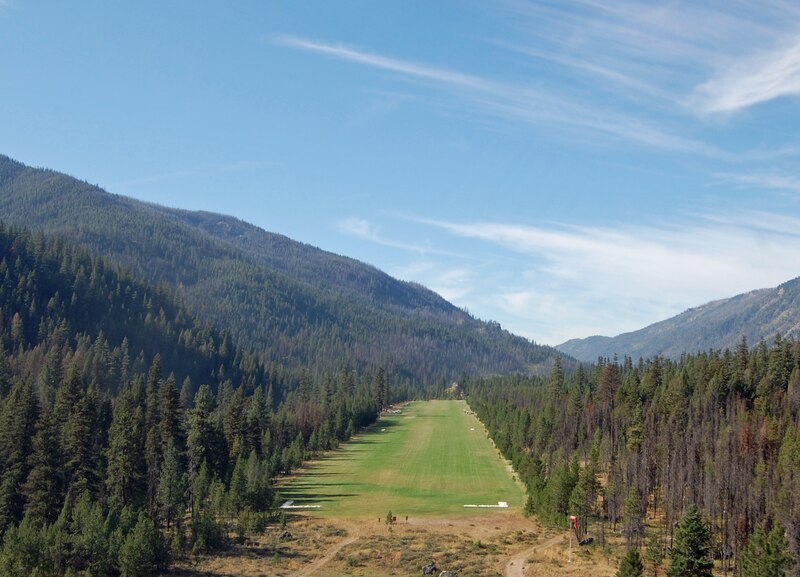
Quick reference: Minam Lodge (private strip, no identifier) features a 2,200-foot grass runway at 3,520 feet elevation. The strip runs northeast-southwest with trees on both ends requiring precision approaches. Contact the lodge at 541-432-9171 for landing permission and reservations. Expect one-way-in/one-way-out operations with challenging terrain. Best access is May through October when the strip is maintained.
Runway and Approach Details
The grass strip measures approximately 2,200 feet long and 100 feet wide. Surface conditions vary with weather – soft after rain, firm in dry periods. The northeast approach offers a better gradient but requires clearing tall pines. The southwest approach follows the river valley with rising terrain on departure.
Field elevation is 3,520 feet, requiring density altitude calculations on warm days. No lights or visual approach aids exist. Winds typically flow along the river valley. The surrounding mountains create mechanical turbulence in afternoon heating. Plan arrivals for morning calm conditions.
Aircraft Requirements
Tailwheel aircraft with STOL capabilities are strongly recommended. Plan for 1,000-1,200 foot landing distances with obstacles. High-wing aircraft provide better visibility of the narrow valley. Minimum recommended horsepower is 150 for reliable departures at density altitude.
Probably should have led with this, honestly: avoid operating with full gross weight. Performance margins are minimal. The lodge can accommodate approximately 10-12 aircraft on the ramp area.
Approach and Departure Procedures
Overfly the strip at 1,000 feet AGL to check the windsock and surface conditions. Enter a left pattern for the northeast landing direction. Final approach requires a steep descent angle to clear approach trees. Aim for the numbers to maximize rollout distance.
Departures favor the southwest direction when possible due to terrain clearance. Backtaxi the full length before turning around. Use short-field technique with full power against brakes. Maintain runway heading until clearing the trees, then turn to follow the river valley.
Seasonal Considerations
The lodge operates late May through October, matching the strip’s usable season. Early season brings softer field conditions from snowmelt. July and August offer the best weather but highest density altitudes. September provides excellent flying with fall colors and cooler temperatures.
Winter snow closes the strip from November through April. Contact the lodge before departure to verify current field conditions.
Accommodations
Minam Lodge offers rustic cabins with meals included in overnight packages. The main lodge building serves family-style dinners. Fishing the Minam River for trout is excellent. Hiking trails access the surrounding wilderness. Cell service is non-existent – bring satellite communication.
Fuel is not available – plan accordingly. Reservations are required and book months in advance for peak season weekends.
Emergency and Communication
The nearest airport with services is La Grande Municipal (LGD), 35 miles northeast. Emergency services require helicopter evacuation due to the remote location. Carry a satellite messenger or InReach device. File a flight plan and update it upon arrival.
That’s what makes flying to Minam Lodge serious backcountry aviation – you need skills, preparation, and appropriate aircraft. But for those who are ready, it’s one of the most rewarding destinations in the Pacific Northwest.


Leave a Reply