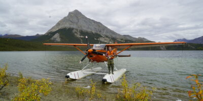
Stehekin Airport sits at the head of Lake Chelan in Washington’s North Cascades, serving one of America’s most remote communities. This tiny mountain town of 75 year-round residents relies on float planes, boats, and hiking trails for access—no roads connect Stehekin to the outside world. The 3,140-foot gravel strip provides the only land-based aircraft access to this wilderness outpost.

Quick Answer: Stehekin Airport (68S) features a 3,140-foot gravel runway at 1,160 feet elevation in Washington’s North Cascades. The strip runs roughly north-south with trees on both approaches and rising terrain. Operated by the National Park Service. No services available—bring fuel, tools, and supplies. Best season is May through October. Contact North Cascades National Park: (360) 854-7200. The remote location requires mountain flying experience and careful planning.
Airport Configuration and Runway
The runway measures approximately 3,140 feet long and 60 feet wide. Gravel surface maintained by the National Park Service. Elevation is 1,160 feet, relatively low for mountain strips but surrounded by peaks exceeding 8,000 feet. The runway orientation is roughly north-south (01/19) with minimal slope. Surface conditions vary seasonally—firmest in late summer, softer after spring rains.
Trees line both ends of the runway requiring clear approaches. The valley narrows significantly, channeling winds and creating turbulence. No lighting exists—operations are day VFR only. The parking area accommodates 4-6 aircraft on grass tiedown spots. No fuel, no facilities, no services. The town of Stehekin sits about 1 mile from the airport via walking trail or shuttle.
Access and Navigation
Most pilots approach from the south following Lake Chelan’s 50-mile length. The lake valley provides a natural navigation aid and emergency landing area. Typical departure points include Wenatchee (EAT), Chelan (S10), or other eastern Washington airports. The flight time from Wenatchee is approximately 30 minutes.
Overfly the strip initially to check windsock, surface conditions, and traffic. No CTAF or Unicom exists—pilots self-announce on 122.9 for local traffic advisories. Enter a standard pattern at pattern altitude. The valley’s narrow configuration and surrounding mountains create downdrafts and turbulence, especially in afternoon heating. Morning flights offer calmer conditions and better performance.
Approach and Landing Procedures
Standard operations favor landing to the north when winds permit. The southern approach follows the lake valley with reasonable terrain clearance. Final approach requires clearing trees at the threshold. Aim for the first third of the runway to maximize rollout distance. The gravel surface provides good braking but requires speed control.
Mountain wave and thermal activity affect approach stability. Wind patterns funnel through the valley, creating gusty conditions. Crosswinds can be significant despite the valley’s alignment. Expect rollout distances of 1,000-1,500 feet depending on aircraft type and density altitude. Taxi slowly to minimize gravel impact on propeller and landing gear. Parking spots fill quickly during summer weekends—arrive early for space.
Departure Procedures and Performance
Departures typically use the full runway length, taxiing to the northern end. Southbound departure follows the lake valley with good terrain clearance. Calculate takeoff performance carefully—summer afternoon density altitudes reach 3,000-4,000 feet despite the relatively low field elevation. Heat and moisture from the lake affect density altitude significantly.
Most aircraft require 1,500-2,000 feet for takeoff in typical conditions. Morning departures provide better performance than afternoon operations. If not flying by two-thirds down the runway, abort and reassess weight or conditions. The valley provides good escape routes following the lake. Climb above surrounding ridges before turning away from the valley to avoid terrain and turbulence.
Weather and Seasonal Considerations
The airport operates May through October typically. Spring brings higher water levels in Lake Chelan and potentially soft runway conditions from snowmelt. July and August provide the most reliable weather but highest temperatures and density altitudes. September offers excellent flying with fall colors and cooler temperatures. Snow closes the strip November through April.
Weather changes rapidly in the North Cascades. Morning starts clear, afternoon thunderstorms develop. Mountain wave activity creates severe turbulence in strong winds. The narrow valley amplifies and channels winds. No weather reporting exists at Stehekin—pilots must assess conditions visually or obtain pilot reports. Wenatchee AWOS (30 miles south) provides general trends but not local conditions. Always have alternate plans with fuel to return to departure point.
Town Activities and Accommodations
Stehekin offers rustic accommodations including the North Cascades Lodge, rental cabins, and National Park Service campgrounds. The bakery is legendary among visitors—arrive early for pastries that sell out daily. Restaurants operate seasonally with limited hours. The town has no cell service—pay phones and satellite communication only.
Hiking trails access the North Cascades backcountry. Rainbow Falls (3.5 miles) is a popular destination. The shuttle bus provides transportation to trailheads and points of interest. Mountain biking trails wind through the valley. Fishing in Lake Chelan and streams is excellent. The remoteness and natural beauty attract adventurous pilots seeking wilderness experiences. Most visitors spend 1-2 nights exploring the area.
Aircraft Requirements and Recommendations
Tailwheel aircraft are strongly preferred but not required. The gravel surface and mountain environment favor rugged aircraft. Minimum recommended horsepower is 150 hp, though 180 hp provides better margins. Popular aircraft include Super Cubs, Cessna 180/185s, Maules, and Huskies. Larger aircraft like Cessna 206s operate successfully.
Remove wheel pants for gravel operations. Bring tie-down stakes and chains—winds can be severe. Pack survival gear including food, water, shelter, and first aid. Carry tools for basic field repairs. Satellite messenger or PLB is essential—no cell coverage exists for emergencies. The remote location and lack of services demand self-sufficiency. Plan fuel carefully—no fuel available within 50 miles by air.
Safety Considerations
Stehekin requires genuine mountain flying proficiency. The narrow valley, unpredictable winds, and surrounding terrain create challenging conditions. Don’t attempt Stehekin as your first backcountry strip. Build experience at easier locations first. Consider mountain flying training with an experienced instructor before visiting.
The National Park Service may close the strip temporarily for wildlife, maintenance, or hazardous conditions. Call ahead to verify current status. Be prepared for rapid weather changes requiring altered plans. The combination of remote location, gravel surface, and mountain environment demands respect. Study accident reports and connect with experienced pilots before your first visit. The RAF (Recreational Aviation Foundation) provides excellent resources. Stehekin rewards prepared pilots with an unforgettable wilderness flying experience in one of Washington’s most spectacular locations.


Leave a Reply