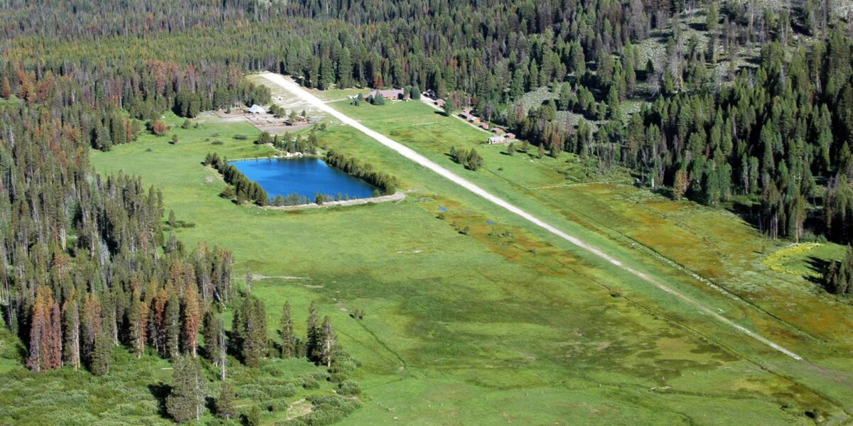
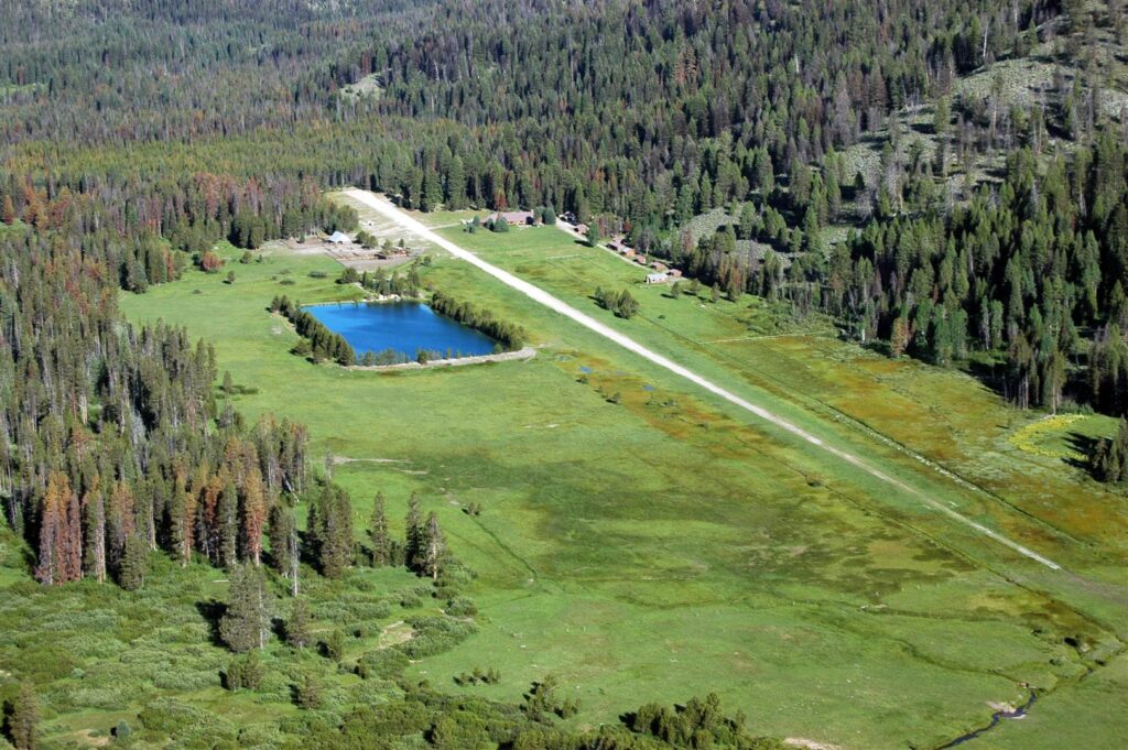
Sulphur Creek’s one of those Idaho backcountry strips that doesn’t try to kill you. That’s why it’s perfect if you’re just getting into this whole mountain flying thing. You get the real backcountry experience – gravel strip, no services, middle of nowhere – but with a runway long enough that you won’t be white-knuckling it on every landing.
Quick Answer: Sulphur Creek (U80) has a 2,900-foot gravel runway at 3,920 feet elevation in central Idaho’s wilderness. Runs east-west with a 2-3% upslope to the west. Natural hot springs are a half-mile hike from the strip. Open May through October. Call Payette National Forest at (208) 634-0400 before you go. Need 150+ hp and mountain flying experience, but this is honestly one of the easier Idaho strips. Most pilots use it as their first backcountry airport – it’s that forgiving.
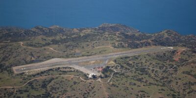
The Strip Itself
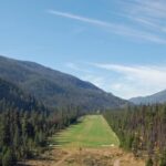
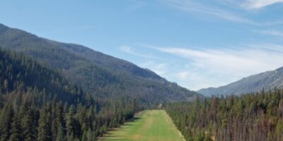
You’re looking at 2,900 feet of gravel, about 70 feet wide. Forest Service keeps it graded pretty well during summer. At 3,920 feet elevation, it’s way lower than most Idaho strips – your density altitude won’t be insane even on warmish days.
The runway runs east-west with maybe a 2-3% upslope heading west. That grade’s your friend – makes westbound landings way shorter. Surface is firmest in late summer, gets a bit soft after snowmelt or rain. Still, it’s smooth compared to those gnarly strips with washboards and potholes. Trees on the north side, creek flowing along the south. Both ends have decent terrain clearance, so approaches aren’t those butt-clenching one-way deals.
Landing Here
Most people land westbound uphill on 27 when winds allow. Standard procedure – overfly at 1,000 AGL, check the sock, look for anybody else down there. CTAF’s 122.9. Make your calls.
Left pattern for 27 works fine. No crazy terrain messing with your pattern like some strips. Final comes in over the creek valley – plenty of clearance. Keep your normal approach speed till you cross the threshold, then chop power and let that uphill runway slow you down. Most planes stop in 1,500-2,000 feet easy. Aim for the first third so you’ve got runway ahead of you. The gravel brakes great. Just taxi slow to parking – nobody likes propeller strikes from kicked-up rocks.
Getting Out
Departures? Eastbound downhill on 09’s what you want. Taxi all the way to the west turnaround and use every inch. Now here’s the thing – summer afternoons push density altitude to 6,000-7,000 feet. A 182 at gross needs maybe 1,800-2,200 feet in those conditions. That downhill slope cuts it to 1,200-1,600 feet actual ground roll.
Morning departures are way better. You’ll see density altitude drop 1,500-2,000 feet compared to afternoon. Makes a huge difference. Use short-field technique every time – full power against the brakes, smooth release, let ‘er roll downhill. Most planes are flying by mid-runway. Terrain drops away to the east so you’ve got good clearance. Follow the drainage initially before turning wherever you’re headed. Watch those engine temps on the climb out.
The Hot Springs
Okay, this is why people actually fly here. Natural hot springs half a mile from the parking area via a maintained trail. Multiple pools ranging from 95° to 110°. Room for 4-8 people depending on how friendly everyone’s feeling. Soaking after a flight? Pretty much perfect.
Just don’t be that person who uses soap in the springs. Pack out your trash. It’s a natural area – keep it nice. Forest Service maintains some camping spots near the airport with vault toilets. Creek water needs filtering. No fuel, no power, no nothing. There are fire rings but check for fire restrictions first. Oh, and it’s bear country – hang your food or use a bear can. Carry spray when you’re hiking around. Most folks spend a couple nights here just relaxing.
When to Go
Strip’s open May through October usually. Early season’s got softer runway from snowmelt but the creek’s flowing nice. July and August? Firmest runway, warmest weather for the hot springs. September’s honestly the best – fall colors, fewer people, still great weather. Snow shuts everything down November through April.
Summer afternoons bring thunderstorms pretty regularly. Get there in the morning. You’ll also dodge the worst thermal activity and afternoon winds. Winds typically run along the valley so they’re usually reasonable. Weather changes fast up here though – always have a plan B. Nearest real airports are McCall (MYL, 30 miles northwest) and Cascade (U70, 25 miles west) if you need fuel or better weather info.
What Flies Here
I’ve seen everything from 172s to King Airs use this strip. Most common? 182s, 206s, Super Cubs, Maules, Huskies. The long runway and moderate elevation make it way more forgiving than the gnarly strips. Minimum’s probably 150 hp, but 180 hp gives you better margins, especially for afternoon departures when it’s hot.
Tailwheel’s preferred but trikes do fine if you know what you’re doing. Pull your wheel pants for gravel ops. Bring tie-down stakes and chains – not a ton of trees in the parking area. There’s room for maybe 10-15 planes. Pilot skill matters way more than what you’re flying. Respect the environment no matter what you’re in.
Training Stuff
This is honestly a great first Idaho backcountry strip. The runway’s long, the gradient’s moderate, elevation’s reasonable. But don’t get cocky – it’s still legit backcountry flying. Get proper mountain flying training first. RAF (Recreational Aviation Foundation) runs good courses. Lots of independent instructors too.
Practice your short-field work at home. Actually understand density altitude – not just the theory, but how it affects your specific plane. Talk to pilots who’ve flown Idaho backcountry. Better yet, fly with an instructor your first time. Most pilots use Sulphur Creek as a stepping stone before hitting Johnson Creek or Big Creek. The skills you learn here transfer directly.
Other Stuff to Do
Besides the hot springs, there’s hiking all over. Creek’s got cutthroat trout if you fish. Elk, deer, black bears – wildlife’s everywhere. It’s just beautiful country, and it’s accessible without being stupid-scary to fly into.
Several other strips are nearby – Big Creek’s 15 miles northeast, Johnson Creek’s 20 east, Chamberlain’s 30 north. A lot of pilots do multi-day trips hitting several strips. Central Idaho’s got dozens of backcountry airports within 50 miles. The combo of decent flying, gorgeous scenery, and those hot springs makes Sulphur Creek one of Idaho’s most popular backcountry destinations.
Don’t Be Stupid
Look, Sulphur Creek’s forgiving for Idaho backcountry, but it still demands respect. Do your weight and balance. High density altitude punishes overweight planes. Bring real survival gear – shelter, food, water purification, first aid, satellite comm. Cell service? Forget it. If something goes wrong, rescue takes hours or days.
File a flight plan. Tell someone where you’re going. Bring tools for basic repairs. You’re on your own out here. Weather changes fast – be conservative. Forest Service sometimes closes the strip for maintenance or fire danger – call ahead. Thousands of pilots visit safely every year by planning carefully and not being idiots. The hot springs and scenery make it totally worth the trip if you do it right.


Leave a Reply